
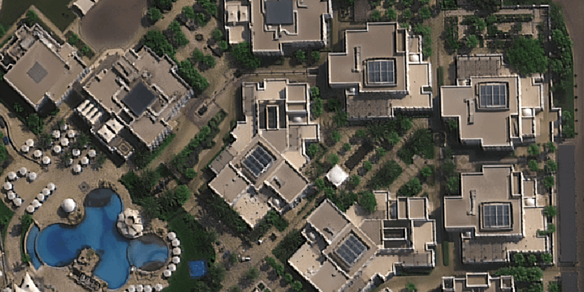
In real estate, the things you can’t see are usually what kill a deal. For years, we had to rely on dusty county records, blurry lot photos, and whatever the seller decided to mention. But let’s be honest, that just doesn’t cut it anymore. By checking live satellite images, you can spot major red flags or hidden gems before you even visit the object. Instead of just taking someone’s word for it, you hand your clients hard proof, building trust faster than any sales pitch ever could.
Forensic Property Evaluation and Verification
Let’s be real: sellers don’t always know, or share, the full story of a property. That gorgeous, empty lot you are walking on today? Ten years ago, it could have been an industrial scrapyard or a leaky gas station. Not the best neighborhood, isn’t it? By pairing historical records with live satellite imagery for any user, you can hit rewind and see exactly what was sitting on that dirt before the current owners bought it. It provides raw, unfiltered proof of how the land was actually used, letting you lock in the property’s history without second-guessing.
- Unpermitted additions: Catch illegal guest houses, forbidden roof extensions, or concrete decks that never saw a city inspector.
- Illegal land clearing: Check if the owner aggressively destroyed protected tree lines, wetlands, or the neighbor’s yard.
- Disputed dimensions: Double-check the actual lot size and building characteristics so your listing is legally accurate and ready for the appraiser.
Research shows that pricing a property using a mix of street views, satellite shots, and detailed descriptions is far more accurate than just relying on past sales numbers alone.
Environmental Risk Assessment and Infrastructure Tracking
Figuring out what a property is really worth means looking way past the fence line. The surrounding environment plays a massive role in whether a home gains value or becomes a liability. Weather patterns and risks are changing a lot faster than city governments can update their hazard maps, which leaves buyers completely blind to natural dangers.
By checking live satellite images of Earth, you can spot environmental red flags that you would never notice just walking through the front yard. You can figure out:
- where water actually pools after rains and catches hidden flood zones,
- how thick the brush is nearby for fire risks,
- eroding coastlines or shifting dirt, if you are looking for real estate by the sea or river.
Showing your clients this kind of visual proof stops you from sounding like just another salesperson and turns you into a trusted advisor who actively protects their money.
Modernizing the Listing and Client Experience
Of course, if you buy a house or apartment, you want to know more about the whole neighborhood, and actually, very high-resolution satellite imagery for 3D reconstruction and classification has enormous potential. In this case, detailed listings with satellite images of the surrounding area will look more attractive. For instance, you can have a look at the real walking route to the local elementary school, or just figure out how close the house is to a noisy highway. This is a game-changer, especially for non-local or international clients who can’t just drive by or speak to neighbors. When remote buyers can view live satellite images to check out the neighborhood density and local traffic for themselves, they feel way more comfortable. By keeping a solid live satellite view app on your phone during showings, you have all the answers right in your pocket. It completely changes how you handle property tours:
- On-the-spot answers: Clear up boundary confusion or figure out what that big commercial building next door actually is, right then and there.
- Better remote tours: Walk out-of-town buyers through a property virtually while sharing your screen to show exactly where the house sits in the broader city.
- Look like a pro: Show up prepared. Today’s buyers do their homework, and having this tech ready proves you know your stuff better than they do.
Conclusion
Real estate is moving faster than ever. If you are still relying on archive maps or just crossing your fingers that a seller is telling the whole truth, you are going to get left behind. Pulling up a live satellite view of Earth isn’t futuristic anymore. You can easily catch hidden environmental risks, prove the land’s history, and give your buyers an honest picture. At the end of the day, it is all about protecting your client’s money and proving you are the sharpest agent in the room. Bring these tools into your daily routine, and watch both your reputation and your closing rate take off.
Author :
Kateryna Sergieieva has a Ph.D. in information technologies and 15 years of experience in remote sensing. She is a scientist responsible for developing technologies for satellite monitoring and surface feature change detection. Kateryna is an author of over 60 scientific publications.
More Stories
Smart Tech thehometrotterscom – Essential Gadgets, Apps, And Setups For 2026
Durostech Explained: What It Is, How It Works, And Why It Matters In 2026
GeekForce Network: The 2026 Guide To What It Is, How To Use It, And How To Grow Your Presence